Standing in front of Angkor Wat, almost everyone asks the same three questions: who built this, how, and what happened to them? The answers are better than the guidebook version — and in the last two decades, tree-ring science and airborne lasers have rewritten large parts of the story. Here is the empire behind the temples, from its founding on a sacred mountain to the droughts that broke it.
802 AD: A King Declares Himself a God
The conventional starting point is a ceremony on Phnom Kulen, the plateau northeast of modern Siem Reap, where in 802 AD a ruler named Jayavarman II had himself consecrated chakravartin — universal monarch — and declared independence from Javanese overlordship. The rite established the devaraja ("god-king") cult that would justify six centuries of monumental building: a king who is a channel for divine power needs a temple that proves it.
His capital up on the Kulen was called Mahendraparvata, "the mountain of the great Indra." For twelve hundred years it was known only from inscriptions. We will come back to how it was found.
The Move to the Plains — and to Water
Jayavarman II's successors came down off the mountain to the flat, well-watered plain northwest of the Tonlé Sap, and the empire's real genius emerged: hydraulic engineering. Beginning at Hariharalaya — today's Roluos group, 13 km east of Siem Reap, where Bakong (881) became the first great sandstone temple-mountain — Khmer kings built reservoirs (baray), canals, moats, and embankments on a scale nothing else in the medieval world matched.
This was not decoration. The region gets almost all its rain in a few monsoon months and then goes dry for half the year. Store that water and you can support extraordinary population density; fail to store it and you cannot. The West Baray, dug in the 11th century, is roughly 8 km by 2 km and still holds water today. The moat around Angkor Wat — about 190 m wide and more than 5 km around — does structural work too, stabilizing the groundwater under the temple, which is a large part of why it still stands nearly level after nine centuries.
The Great Builders
Suryavarman II (reigned c. 1113–1150): Angkor Wat
The empire's most famous king built its most famous building, dedicating it — unusually — to Vishnu rather than Shiva, and orienting it west, the direction of both Vishnu and death, which is one reason many scholars read it as a funerary temple as well as a state temple. The main structure went up in roughly three decades: sandstone quarried at Phnom Kulen some 50 km away, floated and hauled by canal, raised with elephants and an organized labour force running into the tens of thousands. Our visiting guide walks you through what he left behind, gallery by gallery.
Jayavarman VII (reigned c. 1181–1218): the builder-king
After the Cham sacked Angkor in 1177, Jayavarman VII drove them out and then launched the most intense construction programme in Khmer history. He was a Mahayana Buddhist, and the empire's religion swung with him. In roughly forty years he built the walled city of Angkor Thom with the Bayon and its serene stone faces at its centre; Ta Prohm for his mother and Preah Khan for his father, each a monastic city housing thousands; the healing shrine of Neak Pean; and — according to inscriptions — a network of rest houses and hospitals along the empire's roads. It is a staggering output, and it may have cost more than the treasury could bear.
How Big Was Angkor, Really?
Here the story becomes modern. In April 2012, an international consortium led by archaeologist Damian Evans flew a helicopter-mounted LiDAR scanner over 370 km² of Angkor, Phnom Kulen, and Koh Ker — about twenty hours of flying that stripped the forest canopy away digitally and revealed the ground beneath. A far larger follow-up survey in 2015, under Evans's Cambodian Archaeological LiDAR Initiative, mapped more than 3,000 km².
What the lasers showed changed the picture: not isolated temples in jungle, but a vast, formally planned urban landscape — grids of embankments aligned to the cardinal directions, house mounds, ponds, field systems, and roads, into which the great temples were integrated. Angkor was a low-density city sprawling across roughly a thousand square kilometres, plausibly the largest pre-industrial settlement complex on Earth. And on the Kulen plateau, the survey finally traced the lost capital of Mahendraparvata itself, some 350 years older than Angkor Wat, laid out on a deliberate grid.
Why It Fell: the Modern Answer
For a long time the standard explanation was simple: the Siamese kingdom of Ayutthaya sacked Angkor in 1431, the court moved south toward Phnom Penh, and that was that. The invasion is real. But it now looks like the final shove rather than the cause.
In 2010, researchers published a hydroclimate reconstruction stretching back seven and a half centuries, built from the growth rings of long-lived cypress trees in southern Vietnam. The record showed that Angkor was struck by two prolonged, severe droughts — one in the mid-14th century, another in the early 15th — each lasting decades, and each punctuated by unusually intense monsoon years.
For a city that was a water-management machine, this was close to a worst-case scenario. Decades of drought would have crippled the reservoirs and the rice yields they irrigated; the violent wet years between them would have torn at canals, embankments, and spillways that were already stressed. Excavations at the outlets of the great barays have found evidence consistent with exactly that kind of damage. Add the strains that were already there — the fiscal weight of Jayavarman VII's building programme, a religious shift from state Hinduism toward Theravada Buddhism that undercut the god-king logic, silting infrastructure, growing trade opportunities on the coast, and pressure from Ayutthaya — and you get what the researchers themselves describe: not one cause, but a complex failure with social, political, and environmental strands.
Note also what did not happen. Angkor was never abandoned and never "lost." Monks maintained Angkor Wat continuously; Khmer people always knew exactly where it was; 16th-century Portuguese and Spanish visitors wrote about it. The romantic tale of Henri Mouhot "discovering" it in 1860 is a colonial framing, not a fact — more myths dismantled in our Angkor Wat facts piece.
Seeing the History on the Ground
The chronology is legible if you visit in the right order:
- Roluos (9th c.) — Bakong, Preah Ko, Lolei: the prototypes, and the quietest morning at Angkor.
- Ta Keo (early 11th c.) — the unfinished temple, all geometry and no carving: Khmer engineering with the decoration stripped away.
- Angkor Wat (12th c.) — the empire's peak argument, in stone.
- Angkor Thom, Bayon, Ta Prohm, Preah Khan (late 12th c.) — Jayavarman VII's Buddhist crescendo.
- The Angkor National Museum — an hour here before your first temple day makes all of the above legible instead of decorative.
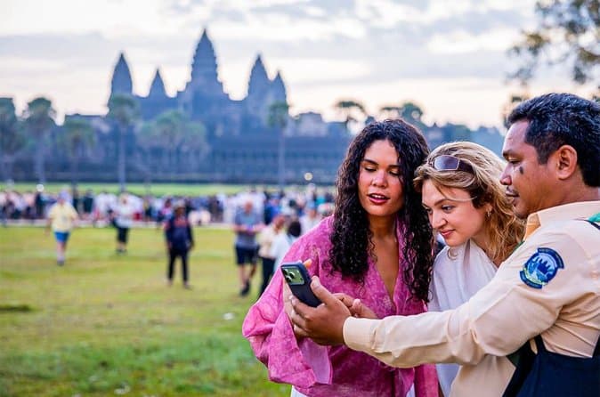
A good guide is the difference between beautiful stones and a story you can follow — which is the strongest argument for a guided first day:
Then keep going on your own: the 3-day itinerary sequences the chronology sensibly, and the temples section has a deep-dive on every major site.
The Uncomfortable Modern Echo
It is hard to read the Angkor research without noticing the parallel. A sophisticated civilisation built extraordinary infrastructure precisely tuned to a climate that was stable — until it wasn't. The infrastructure that made the city possible became the thing that could not adapt fast enough. Today the region faces its own water-system stress on the Tonlé Sap, from upstream dams and sand mining rather than monsoon failure. The Khmer built the most impressive hydraulic city the medieval world produced. It was not enough. That is worth thinking about on the causeway at dawn.